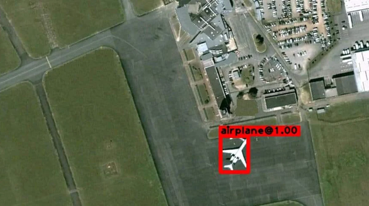
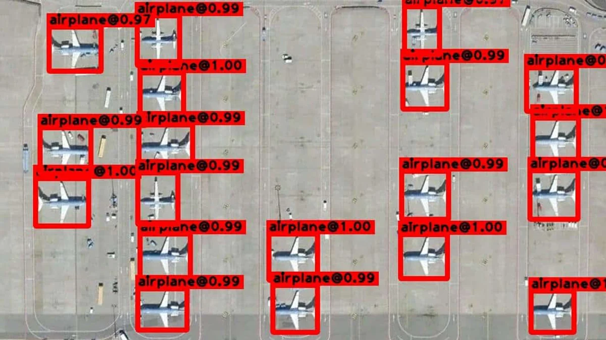
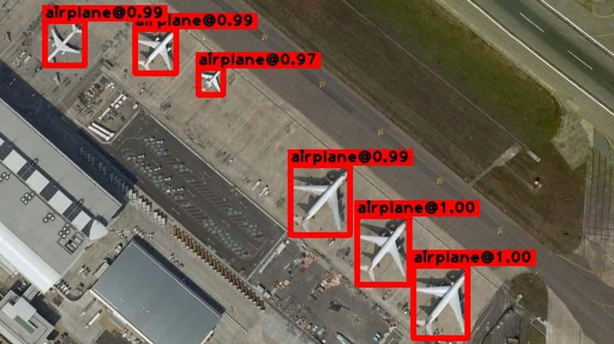
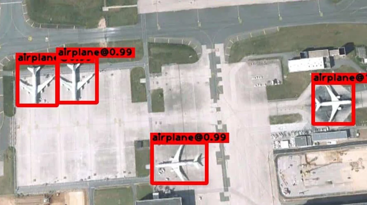
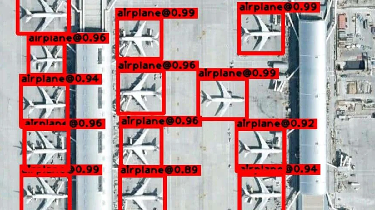
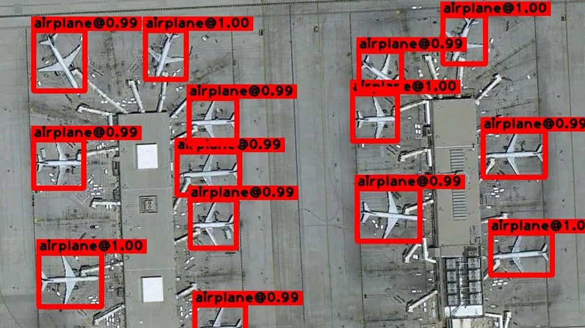
Geospatial Airplane Detector
Detects commercial airplanes from satellite angles. Off-the-shelf, powers alternative data. Custom add-ons for shipping and military aircraft.
Specifications
Performance
Optimized for edge performance with a low power profile.
Perspective
Performs on viewing angles from 60 to 90 degrees.
Conditions
Dawn to dusk.
Environment
Environmentally-agnostic performance.
Functionality
Detection.
Sensor Modality
Visible light.
Use cases
Localize, detect, and count aircraft from satellite angles.
Alternative data
Use the Geospatial Airplane Detector to aggregate alternative data on tourism, flights, and airlines. It can be used to count docked airplanes over airports via satellite and aircraft.
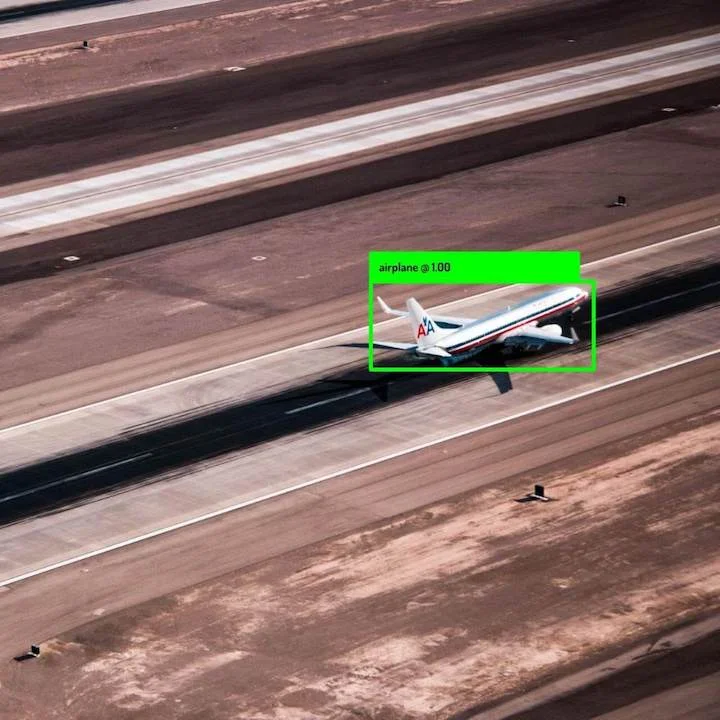
Aerial security
Ensure safe environments and flights with real-time aircraft detection in unknown environments. Military aircraft classification is available as a custom add-on.
Surveying
Use this algorithm in your broader aerial surveying system to detect and analyze aircraft patterns.